It was the best of roads and the worst of roads. The ‘road’ was wide enough, and it belonged to the genre of rock. Once upon a time human hands had tried to create proper roads here. But memories of metal were long gone. Our car, an otherwise comfortable and large Innova, behaved more like a boat on choppy waters. We had been forewarned. Our incomparable driver Kishore-ji had smiled and said, “Sir, this is Gramphu, from here starts the path of nightmares.” The road may have been at times nightmarish, and quite often downright life-threatening, yet it took us through such a part of the world, calling it magnificent would be a gross understatement.

But as always I begin in the middle. Let me begin at the beginning.
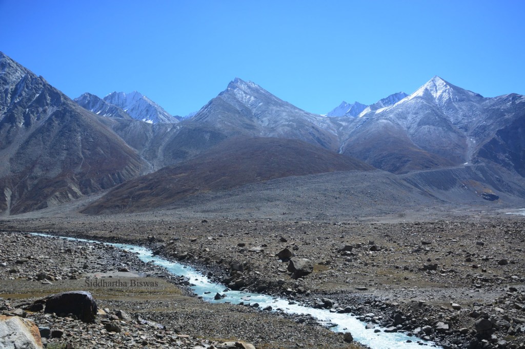
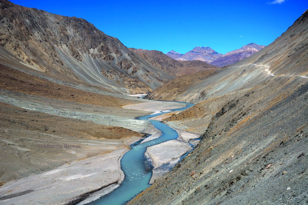
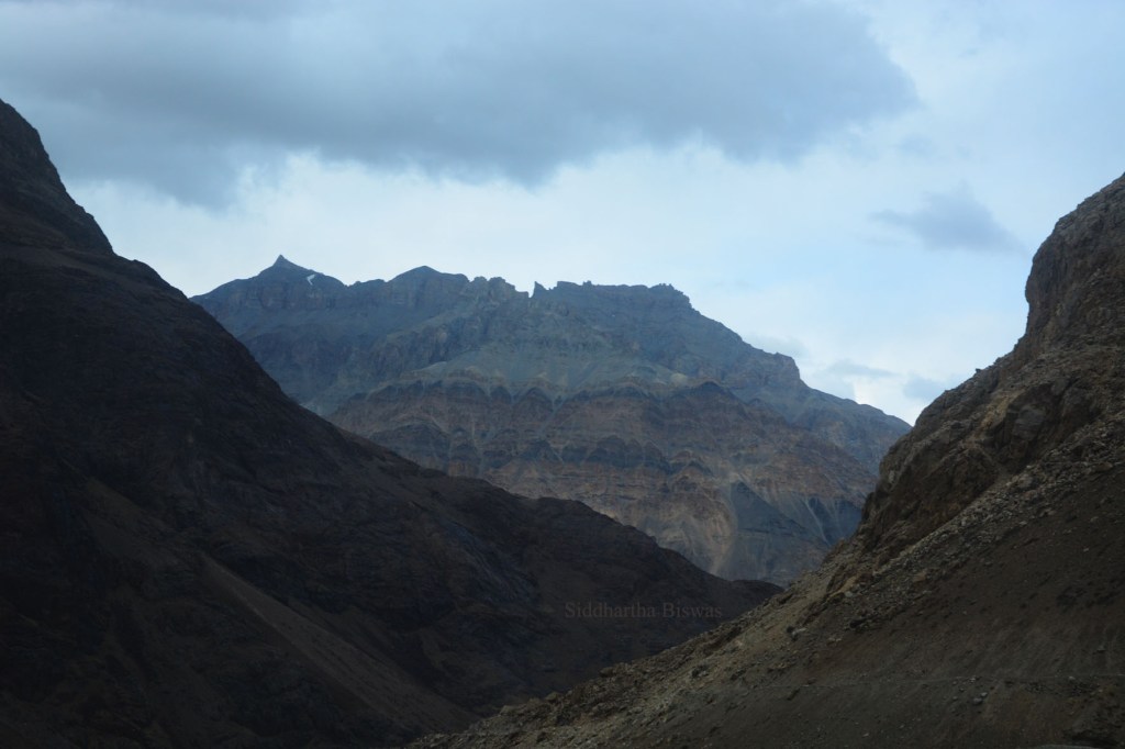
We left Keylong early – 6:15 in the morning. Google mapped a journey of six hours, Kishore-ji mentioned 12. Since we always want more, we trusted Kishore-ji. We were leaving Lahaul and moving towards Spiti. From Tandi to Chandra Taal the river Chandra (Moon) would accompany us. This is Moon River country. Most of this specific road, as we heard, is no longer Lahaul, Spiti has taken it over (I told you they have border feuds). And since heavy snowfall makes the road inaccessible for about seven months of the year, attempts at restoring it has become rarer in recent times. Our destination was Kaza, but all those who love journeys would agree that this road is as fascinating as the end. We stopped at Koksar and bought water. It was late in the season and provisions are sparse on the road as they stop storing and start packing. The road officially closes in the beginning of October, but people travel as long as snowfall does not start. We were lucky as we just passed as snowfall was starting. A few minutes after Koksar, Kishore-ji announced the beginning of the (in)famous road. I will give you a few photos and a short video. Words are actually inadequate here.


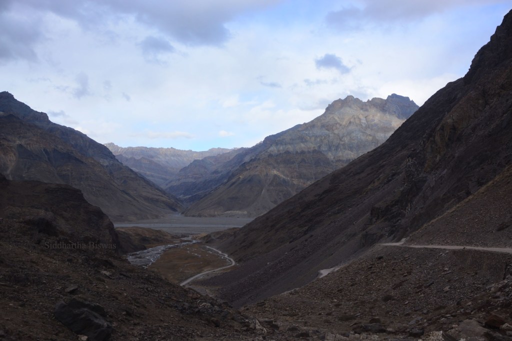
This is NH (abbreviation for National Highway) 505. Before 2014 this was a State Highway. The road, like many other mountain roads around border areas, is maintained by the BRO (Border Roads Organisation, a wing of the Indian Army). The Highway starts at Gramphu and ends at Khab Sangam (which I will speak about in a later post) and has two great Indian rivers as its companion, the rivers Chandra and Spiti. Of its 273 km length, our journey for the day covered about 200 kilos (with 12+12 Ks for the Chandra Taal journey). Right now, the road from Gramphu to Losar is closed as heavy snowfall has turned the place into what it is generally known as – the Lahaul Spiti Cold Desert.
The stoppages at Chhatru (altitude approximately 11,675 feet) and Batal (altitude approximately 13,000 feet) provide some relief, but they also can disappoint with limited choices. {To see my short videos of these places please click on the names.} Of course, the terrain will not let you feel hunger or thirst, it is that amazing.

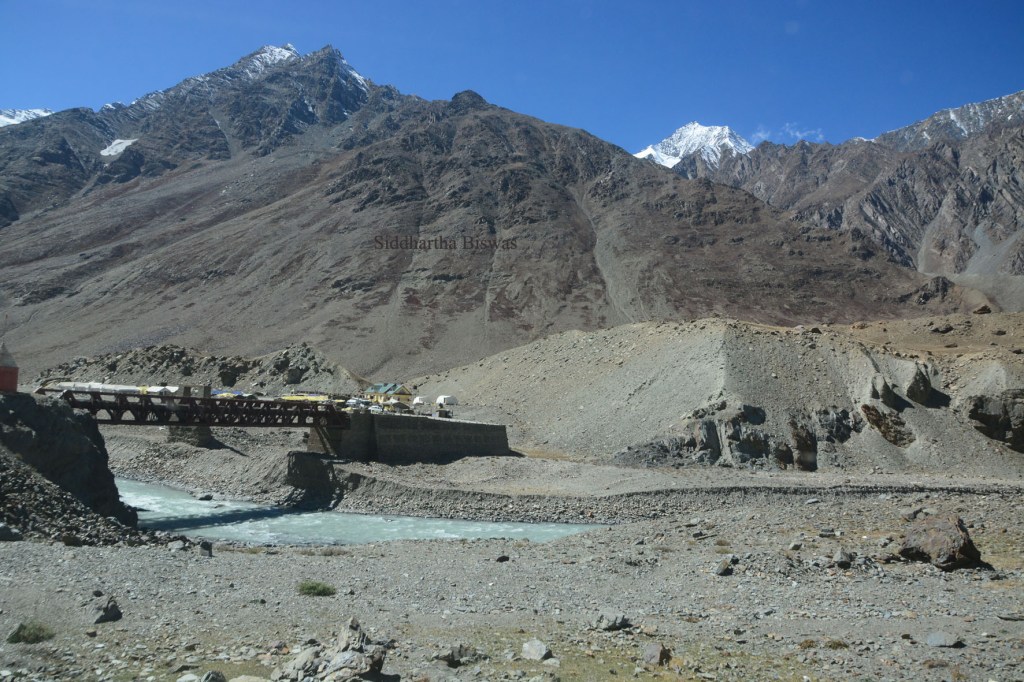
The bridge that you see in the picture above is no longer used. It has, however, a very unique utility. As proper toilets are scarce, its nether regions act as places where you can respond to other calls of nature. Do have a companion who would act as a wall. Privacy is a luxury in such regions.

If you plan to travel through here, please insist on having an experienced driver. We saw cars break down, cars running out of fuel, bad driving and near misses that would have turned fatal, but did not because of Kishoreji’s brilliant driving. He had to steer cars of “expert” drivers and to get them out of mudholes and other problems.

There is a public bus that takes people from Kaza to Manali and vice versa. It would be an interesting journey – though hyper-dusty – but the bus will not take you to Chandra Taal.

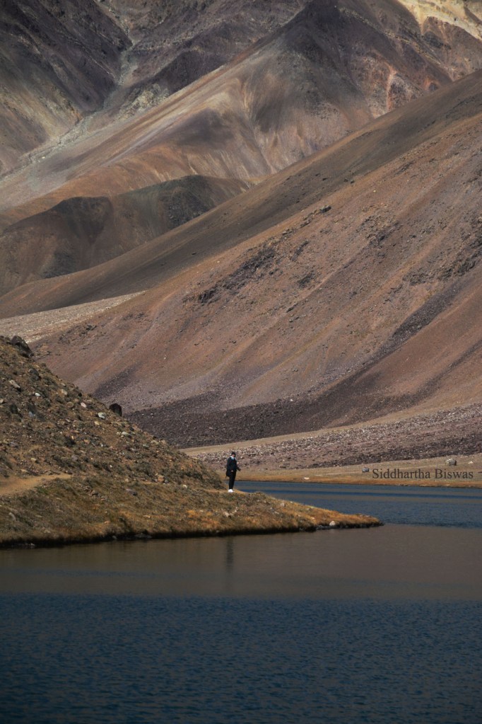
Travelling through this road and not visiting Chandra Taal is a crime. Situated at an altitude of almost 14,000 feet, it is supposedly the origin of river Chandra (which had been with us all this while). The path to the lake is also stunning.

Serenity has its definition here. I have seen Gurudongmar, I have seen Sela, I have seen Khecheopalri, I have seen Chorabari (which is gone now), but this lake is by far the most beautiful. It is so marvellous that I forgot to make a video, even though while walking to it I did make one. This is the link to the video. The glaciers, the hills all around are truly unearthly.
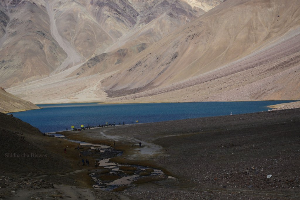
Of course, we had to ignore people whose sole aim in life is to make noise and behave as if they are overenthusiastic amateur acrobats acting in disaster films. Beauty is not appreciated by all. Such a pristine place is violated by hoards of philistines armed with mobile phone cameras. If this was not so well preserved by its remoteness, and rule of the law, I am sure there would be hotels and loudspeakers and such stuff as in the case of Kempty Falls. The campsites are now relocated to a place a few kilometres down, earlier they were allowed to be nearer the lake.

Walk slowly here. Your lungs, as well as your eyes, will demand that. If you have enough time, or if you are staying at the campsite, try to walk around the lake. It is rewarding. And it will take you far away from the mad and madding crowd.
But do leave early, as either way the path is trying. Our walk was stopped by ominous clouds. Years of travelling in the hills teaches you certain things. Coming back to our car we could see snow clouds over the peak on the other side of the river.
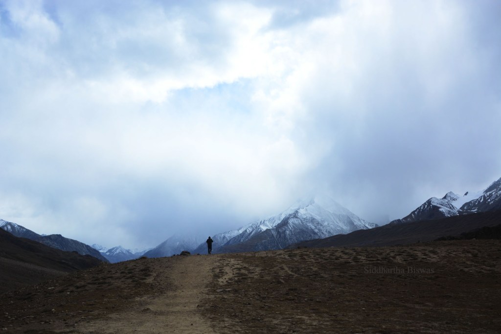
Quite soon the weather changed, the brilliant blue turned into a gloomy gray. You can never trust the weather in the hills, they can turn on a moment’s notice. And mid-October in these hills is always dangerous. Do plan your trip before October sets in – and DO NOT listen to the travel agents (and the internet, which will misguide you just like it does as far as life and politics are concerned).

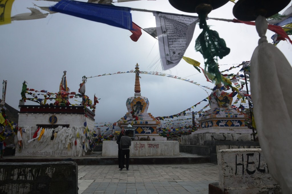
During such weather Kunzum Pass (altitude approximately 15,000 feet) can be deadly. We stopped for a few minutes at the temple of Kunzum Mata. We crossed just as snowfall was starting.
The path then becomes a bit easier and as you lose height, the terrain also seems friendlier.
After Kunzum Pass you will have the company of a tributary of the river Spiti. In fact, it is one of the three main sources and the map calls it Spiti as well. The place where the two meet to create the mighty Spiti riverbed is fascinating to say the least.
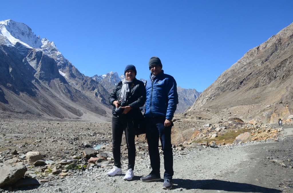
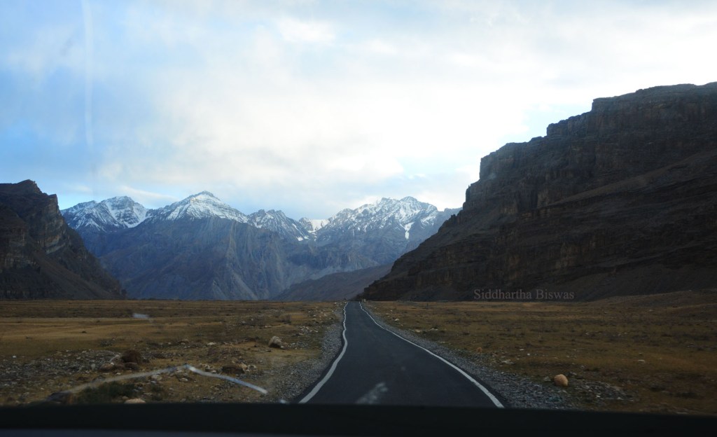
From Takcha the road took the shape of its metallic best. Life started to seem happy and comfortable again. We had never ever appreciated metalled roads as we did at that moment. We had crossed the most perilous part. There would come another one in this trip. Kishore-ji stopped at Lossar and took us to a house. The door was closed and we looked at him with doubt. He laughed and said “They keep them closed for the cold.” And cold it was (altitude approximately 13,500 feet). We were freezing. The coffee and heavily buttered toast seemed blessed.
A few kilometers after Lossar, we came across the loveliest topography known to man. We were driving through a landscape which is once again unparalleled. Even in the falling light we could not allow our cameras to have any rest! I will give you a few shots of those moments in which journey and joy become synonymous, even though the photographs are tragically inadequate.


We reached Kaza at 6 pm. Kishore-ji’s prediction was right. Google may know much, but it has no idea how this particular path is like, and how difficult it is to negotiate. We were tired, but we were fulfilled beyond our dreams. This drive through the magnificent cold desert was more than what we had envisioned. All of you who love roads, who love to travel, and who love mountains – I will strongly urge you to take this journey at least once in your life. The road does not disappoint.
Earlier Posts:

1. Old Lucknow   2. Colonial Lucknow   3. Going Downhill - Versey to Dentam
4. Going to Garhwal  5. The Walkers  6. Palamau  7. Rishikesh
8. Kolkata Kolkata  9. The Roar of the Clouds - Santiniketan
10. Of Pests and Men - Uttarey  11. Where Hikers Fear to Tread - Rudranath
12. Old Times  13. History in Ruins - Pushpagiri
14. Once There was a Heaven  15. Serenity
16. Pilgrim's Progress - Kedarnath 17. Unfinished - Gaumukh 18. Ghatshila
19. Nothing Important  20. Manu's Alaya - Manali  21. Santiniketan
22. Little Lhasa - Dharamshala  23. From Varuna to Assi - Varanasi
24. Tunganath  25. Transitory Blues  26. Gurudongmar  27. The Beginning
28. Yumesamdong  29. Bangali in Bangkok  30. Mukutmanipur
31. Rasvanti  32. The Old Town and the Sea   33. Budapest
34. The Last Post of 2019 35. Travel Travails 36. Cluj-Napoça
37. Presenting the Past  38. Far From the Urban Crowd
39. Silent Night Sleepless Night 40. Norwich 41. Photo Essay - The Road
42. Photo Story - The Days of the Goddess 43. Badrinath 44. Monumental Mistakes
45. Odyssey Now 46. To the Mountains 47. Keylong

I find Google is often quite optimistic when it comes even to country roads here, let alone one such as that one. It reminds me of some of the roads in Ladakh! Thanks for taking us along on your travels!
LikeLiked by 1 person
Moonstruck
LikeLiked by 1 person
A befitting post for such a beautiful stretch of road and the thrilling journey. Really loved the video of the path to Chandra Taal.
LikeLiked by 1 person
My Goodness. What a beautiful place. Your pictures do proper justice to the lovely landscape. Hope to join you and Jaya aunty in one of your many adventures!
LikeLike
This was truly amazing. Hopefully we will soon have another adventure as in Sikkim and that trek through the clouds.
LikeLiked by 1 person